Exploring the Vast Applications of Satellites: From Communication to Climate Monitoring
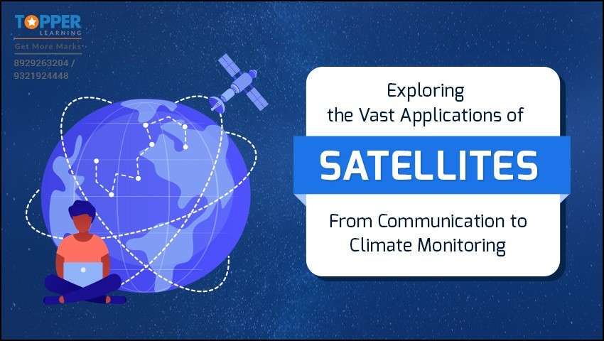
Having explored the fundamentals of satellites and their types in our previous blog, we now delve into the fascinating world of satellite applications and their significance. These ingenious devices play a pivotal role in numerous aspects of modern life and understanding their diverse applications helps us comprehend their indispensable value.
Earlier, we have seen the classification of satellites and now let’s dive deep into artificial satellites. Here we will first examine the architecture of artificial satellites.
A typical satellite comprises several subsystems that work together to fulfil its mission. These subsystems include:

- Payload Subsystem: Based on the objective of the mission, satellite payloads are classified as space science mission payloads, earth observation payloads and communication and navigation payloads.
- Propulsion Subsystem: At times, it’s required to change the velocity of satellites so that they can change their orbit. The propulsion system is nothing but a system that provides the thrust to the satellite and helps it in transporting it from its transfer orbit to the final orbit. Propulsion systems consist of a fuel, propellant tank, combustion chamber and nozzle. There are four types of propulsion systems solid fuel, liquid fuel, electric and ion propulsion system.
- Structural and Mechanical Subsystem: This ensures the structural stability of the satellite during the launch and operations of the satellite.
- Thermal Subsystem: Space has harsh and extreme temperature conditions, so it is essential to maintain the equipment in the operating stage. The thermal subsystem helps in maintaining the required temperature conditions.
- Attitude and Orbit Control Subsystem (ACOS): ACOS places the satellite in a desired orientation and determines its position.
- Electrical Power Subsystem: This subsystem generates, adjusts and store energy necessary for the payload and other subsystems. The power required by satellites is generated through solar panel, which uses solar energy and converts solar energy to electrical energy.
- Telemetry, Tracking and Command Subsystem (TTC): TTC subsystem is responsible for collecting data on all required parameters from all satellite subsystems and relaying them back to ground station.
- Application payloads: A satellite launched into space carry out a specific task. Payloads are the equipment used for performing these specific tasks. Examples: Cameras, Radiometers, Radar, Transponder etc.
Satellite applications are classified according to the types of satellites and as per the task designated to its payload.
Let's explore the distinct types of satellites, exploring their operational methods and diverse applications.
A. COMMUNICATION SATELLITE
Communication satellites are launched into orbit around Earth or other celestial bodies with the primary mission of gathering information and relaying it back to the planet.
India's primary communication satellite system is the Indian National Satellite System (INSAT). The INSAT series is a group of multipurpose geostationary satellites launched and operated by the Indian Space Research Organisation (ISRO). These satellites provide various communication, broadcasting, meteorological, and search and rescue services across India and neighbouring regions. In addition to the INSAT series, India has also launched communication satellites under the GSAT (Geostationary Satellite) series. GSAT satellites are part of ISRO's efforts to enhance and expand the country's communication and broadcasting capabilities.

The application of communication satellites is vast and some of the key applications include:
Telecommunications: Communication satellites form the backbone of global telecommunications networks, enabling voice calls, video conferencing, text messaging, and internet connectivity across vast distances. They facilitate seamless and instant communication between individuals, businesses, and governments worldwide.
Broadcasting: Communication satellites are extensively used for broadcasting television and radio signals. They enable the distribution of TV channels and radio stations to a wide audience, ensuring access to information, entertainment, and educational content.
Internet Connectivity: Communication satellites provide internet access in remote and underserved areas where traditional networks are challenging to deploy. Satellite internet services help bridge the digital divide, connecting people in rural and isolated regions to the online world.
Disaster Communications: During natural disasters or emergencies, communication satellites play a critical role in maintaining communication links. They facilitate coordination between relief agencies, emergency responders, and affected communities, ensuring swift and effective disaster management.
Military Communications: Governments and armed forces utilise communication satellites for secure and encrypted military communications. These satellites offer a reliable and resilient means of transmitting sensitive information and coordinating military operations.
Global Positioning System (GPS): GPS is a constellation of communication satellites that enable accurate positioning and navigation for various applications, from personal devices to vehicles, logistics, and precision agriculture.
Internet of Things (IoT): Communication satellites play a role in enabling global connectivity for IoT devices. They facilitate machine-to-machine communication and data transmission for various IoT applications, including asset tracking and environmental monitoring.
How does a TV works?
Television, commonly known as TV, captures, transmits, and displays audio and visual signals to create moving images and sound.

Here's a simplified explanation of how a TV works:
Capturing the Signal: TV shows, movies, and other content are first captured or recorded using cameras or digital equipment. The visual information is converted into electrical signals, and the audio is converted into corresponding audio signals.
Transmission: These electrical signals are then sent through various means to reach viewers' homes. Traditionally, TV signals were transmitted over the air using radio waves (terrestrial broadcasting). Most TV signals are transmitted through cables (cable TV) or via satellite (satellite TV). Internet Protocol Television (IPTV) is another method that delivers TV signals over the internet.
Reception: At the viewer's end, a TV antenna, cable box, satellite dish, or internet connection receives the transmitted signals.
Decoding the Signal: The received signals contain encoded information that needs to be decoded to retrieve the audio and visual data. In the case of digital TV, the signals are compressed using codecs, and the TV or set-top box decodes the compressed data.
Displaying the Image: The decoded visual data contains a sequence of coloured pixels that represent the moving image. The TV screen's display technology, such as LED, LCD, or OLED, illuminates specific pixels to create the image on the screen.
Sound Output: The decoded audio data is sent to the TV's speakers or an external sound system, reproducing the sound associated with the displayed image.
Control and Interaction: Modern TVs come with remote controls or built-in smart features that allow viewers to switch channels, adjust volume, and interact with various content sources and apps.
Overall, a TV functions as a sophisticated device that translates electrical signals into audio and visual information, providing viewers an engaging and immersive entertainment experience.
B. EARTH OBSERVATIONAL SATELLITE
Satellite remote sensing is a significant technology with diverse applications, including meteorology, disaster monitoring and prediction, land cover classifications, and more. These satellites provide the capability to collect data over vast geographical areas and enable continuous monitoring of surfaces with frequent revisits, surpassing the capabilities of other remote sensing technologies.
India has launched several Earth observation satellites, including the IRS, Cartosat, Resourcesat, RISAT, Oceansat, ScatSat-1, and HySIS series. These satellites are equipped with advanced imaging and sensing instruments to monitor and study various aspects of the Earth's surface, atmosphere, oceans, and resources.

Key applications of Earth observational satellites include:
Agriculture and Crop Monitoring: Satellites enable the monitoring of agricultural lands and crops, providing valuable data on crop health, soil moisture levels, and crop yield estimation. This information helps in optimising agricultural practices and food security.
Urban Planning and Infrastructure Development: Earth observation satellites assist in urban planning by monitoring urban growth, analysing land use patterns, and assessing infrastructure development in cities and urban areas.
Water Resource Management: Satellites monitor water resources, including lakes, rivers, and reservoirs, helping in the management of water supplies, irrigation, and water quality.
Oceanography and Marine Life Study: Satellites provide data for oceanographers to study ocean currents, sea surface temperatures, and marine life. They aid in understanding marine ecosystems and tracking changes in ocean conditions.
Natural Resource Exploration: Earth observation satellites aid in exploring natural resources, such as minerals, oil, and gas, by identifying potential resource-rich areas and geological features.
Biodiversity and Conservation: Earth observation satellites contribute to biodiversity conservation by monitoring wildlife habitats, protected areas and areas with high biodiversity, assisting in wildlife conservation efforts.
Weather Forecasting and Meteorology: Earth observation satellites provide critical data for weather forecasting, monitoring atmospheric conditions, and tracking weather patterns. They help meteorologists predict and understand weather events, including hurricanes, storms and cyclones.
Environmental Monitoring: Satellites play a vital role in monitoring environmental changes and assessing the health of ecosystems. They track deforestation, land use changes, air and water quality and help in studying the impacts of climate change on Earth's environment.
C. NAVIGATIONAL SATELLITE
GPS, a widely familiar technology found in smartphones, cars, watches and other devices, relies on information transmitted by satellites continuously orbiting the Earth to offer navigation assistance. In simple language, this navigation method using satellites is called Satellite-based Navigation. Developed by the USA, GPS is one of the Navigation Satellite systems and nowadays, there are several others like the Indian IRNSS satellite system (NaVic) that provide similar capabilities.

Satellite navigation, also known as Global Navigation Satellite System (GNSS) technology, has various applications across various industries. Some of the key applications include:
Personal Navigation: Satellite navigation is commonly used for personal navigation in smartphones, car GPS systems, and handheld devices. It helps individuals find directions, plan routes and navigate to their desired destinations.
Aviation: Satellite navigation is critical for aircraft navigation, providing precise positioning and route guidance. It enhances safety, efficiency and accuracy in air travel, particularly during take-off, landing and enroute navigation.
Maritime Navigation: Satellite navigation aids maritime vessels in precise navigation, collision avoidance and monitoring of shipping routes. It enhances safety and efficiency in marine transportation.
Transportation and Logistics: Satellite navigation is used in commercial fleets for efficient vehicle tracking, fleet management and route optimisation, leading to cost savings and improved delivery schedules.
Surveying and Mapping: Surveyors and cartographers use satellite navigation for accurate mapping, geodetic surveys, and land boundary demarcation. It helps in creating detailed and up-to-date geographical data.
Agriculture: In precision agriculture, satellite navigation is employed for variable rate application of fertilisers, pesticides, and irrigation, leading to optimised crop yield and resource use.
Emergency Response and Search-and-Rescue: Satellite navigation assists emergency responders in locating and reaching incident sites quickly. It aids in search-and-rescue operations, particularly in remote and challenging terrains.
Disaster Management: During natural disasters, satellite navigation helps coordinate relief efforts, track affected areas, and deliver aid to impacted regions.
Scientific Research: Satellite navigation supports scientific research by providing accurate positioning for data collection in various fields, such as geology, meteorology, and environmental studies.
Time Synchronisation: Satellite navigation is crucial for time synchronisation in global communication networks, financial transactions and scientific experiments.
Public Services and Infrastructure: Satellite navigation is used in infrastructure planning and development, including urban planning, construction, and land use management.
Recreational Activities: Satellite navigation is popular for outdoor activities like hiking, camping, and geocaching, providing real-time location information and trail guidance.
Military and Defence: Satellite navigation plays a critical role in military operations for precise positioning, navigation, and target tracking.
CONCLUSION
As we have explored the world of artificial satellites, we uncovered a realm of innovation, collaboration, and human ingenuity. These orbiting marvels have transcended boundaries and connected us in unimaginable ways, making them indispensable tools for scientific progress, communication, navigation, and exploration of cosmos. At Topperlearning, we strive to foster awareness about satellites and their diverse applications in alignment with the NEP plan. In addition, we offer NCERT Solutions for all grades on our Online Learning Website. Stay tuned to explore India's satellite missions and gain valuable insights into their significance. Keep on checking this space for regular updates!
FAQ's
Q 1. What is GPS?
Ans: GPS, the Global Positioning System, is a satellite-based navigation system developed and maintained by the US Department of Defence. It consists of a constellation of at least 24 satellites that transmit signals to GPS receivers on the ground. By analysing signals from multiple satellites, GPS receivers can calculate precise locations, allowing for accurate navigation and time synchronisation. GPS is widely used in various industries and outdoor activities worldwide and has revolutionised global positioning and navigation.
Q 2. What role do satellites play in navigation systems?
Ans: Satellites play a crucial role in navigation systems, particularly in Global Navigation Satellite Systems (GNSS). GNSS is a constellation of satellites that provides positioning, navigation, and timing information to users worldwide. The most well-known GNSS is the Global Positioning System (GPS) operated by the United States, but there are other systems such as IRNSS (India), GLONASS (Russia), Galileo (European Union).
Indian Regional Navigation Satellite System (IRNSS), also known as NavIC (Navigation with Indian Constellation) is an independent satellite navigation system developed and maintained by the Indian Space Research Organisation (ISRO).
Q 3. How do satellites contribute to weather forecasting?
Ans: Weather satellites provide global coverage and real-time data by remotely sensing Earth's atmosphere and surface conditions. They track storms, monitor cloud patterns, and contribute to climate studies, enabling meteorologists to improve weather forecasting accuracy, early warning systems, and environmental monitoring.
Q 4. How do satellites support scientific research?
Ans: Satellites support scientific research by providing valuable data for Earth observation, climate studies, weather monitoring, space exploration, oceanography, astronomy, geodesy, natural resource management, archaeology, and space physics. They offer global coverage and real-time observations, aiding researchers in understanding environmental changes, climate patterns, celestial objects, ocean dynamics, and space phenomena. Satellite data revolutionizes scientific fields, enhancing our knowledge of Earth, space, and the universe.
Q 5. How do satellites contribute to space exploration?
Ans: Satellites contribute to space exploration by providing communication support, navigation assistance, Earth observation capabilities, and space science missions. They act as communication relays, aid in navigation, observe celestial events, and support space telescopes and probes for studying planets and celestial bodies. Satellites are essential tools that facilitate our understanding of the cosmos and enable successful space missions.
Q 6. How do satellites overcome challenges such as orbital debris?
Ans: Satellites overcome the challenge of orbital debris through collision avoidance maneuvers, end-of-life plans for deorbiting, and active debris removal proposals. They are designed with robust shielding to withstand debris impacts and follow space traffic management protocols to reduce collision risks. International cooperation plays a crucial role in addressing orbital debris, ensuring the long-term sustainability of space activities and safe satellite operations.
Q 7. What is CBSE Skill Education, and what are the books and support materials available for it?
Ans: As per NEP 2020, the Central Board of Secondary Education (CBSE) introduced skill-based education in schools. The aim is to equip students with practical skills to help them in their careers.CBSE has published a range of books and support materials for this purpose, covering various subjects such as Retail, Information Technology, Beauty and Wellness, and more. Topperlearning strives to raiseawareness about the significance of such in-demand skills and topics throughthis blog series.
More from Education


Important Resources
- Education Franchisee opportunity
- NCERT Solution
- CBSE Class 9 Mathematics
- NCERT Solutions for class 10 Science
- Sample Papers
- CBSE Class 9 Science
- NCERT Solutions for class 10 Maths
- Revision Notes
- CBSE Class 10 Hindi
- CBSE Class 10 English
- CBSE Class 10 English
- CBSE Class 10 Social Studies
- CBSE Class 10 Science
- CBSE Class 10 Mathematics
- Career In Science After 10
- Career In Commerce After 10
- Career In Humanities/Arts After 10
- NCERT Solutions for Class 10
- NCERT Solutions for Class 11
- Business Studies Class 12 CBSE project