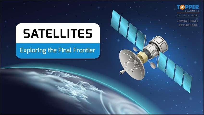
Satellites: Exploring the Final Frontier
WHAT ARE SATELLITES?
Have you ever wondered what enables us to watch the live telecast of the cricket match going on at certain locations directly on our television sets? It is possible with the help of artificial satellites.
A Satellite is a body that orbits around a planet or any celestial body in space.

Primarily satellites are classified as:

Natural Satellites:
The Moon is a natural satellite of the Earth, while the moons of other planets have unique names. For example, Mars has two moons, Phobos and Deimos.
Artificial satellites:
Artificial satellites are designed, manufactured and put into orbit manually to revolve around planets using rockets. Artificial satellites are specifically designed for various purposes, including communication, navigation, weather monitoring, scientific research, and military applications.
They play a crucial role in modern society, facilitating global communication, enabling accurate positioning and navigation systems, and providing valuable data for scientific and commercial purposes.
TYPES OF SATELLITES:
Let us now see how satellites are classified. Satellites are broadly classified based on the following criteria:
(A) Based on the mass of the satellites:

(B) Based on the altitude of the orbit:
The main altitude-based categories of satellites are Low Earth Orbit (LEO), Medium Earth Orbit (MEO) and Geostationary satellite orbit (GEO).
To know more about these satellites, watch the video - Types of artificial satellites based on orbits
(C) Based on the applications
Based on their applications, satellites are classified as follows:
- Communication Satellite
- Navigation Satellite
- Remote sensing or Earth Observation Satellite
- Outer space exploration or Space observatory
INDIAN SATELLITES:
India's satellite programs have been significant achievements for the country, contributing to national development, disaster management, communication infrastructure, and scientific research. These satellites have played a crucial role in providing services to urban and rural areas, connecting remote regions, and gathering valuable data for various applications.

GSAT Series: The GSAT series consists of geostationary communication satellites for various communication purposes, including television broadcasting, telecommunication, and broadband services.
RISAT Series: The Radar Imaging Satellite (RISAT) series is used for all-weather, day-and-night Earth observation. These satellites have synthetic aperture radar to provide high-resolution images for agriculture, forestry, and disaster management.
Cartosat Series: The Cartosat series of satellites are used for cartographic applications and high-resolution Earth observation. They provide detailed images for urban planning, infrastructure development, and natural resource management.
INSAT Series: The Indian National Satellite System (INSAT) series includes communication and meteorological satellites. These satellites provide communication services, weather monitoring, and disaster warning capabilities.
IRS Series: The Indian Remote Sensing (IRS) series is dedicated to Earth observation and remote sensing applications. These satellites capture images and data for agriculture, forestry, water resources, and land-use mapping.
NavIC: The Navigation with Indian Constellation (NavIC) is India's regional satellite navigation system, similar to GPS, providing accurate positioning and timing services over the Indian region.
AstroSat: AstroSat is India's first dedicated multi-wavelength space observatory. It is designed to study celestial sources in different wavelengths, such as X-rays, ultraviolet, and visible light.
SATELLITE COMMUNICATION:
Satellite communication is a process of transmitting information, such as voice, data, and video, using artificial satellites in Earth's orbit. It serves as a vital communication infrastructure that enables long-distance communication across the globe, particularly in regions where establishing traditional communication networks is challenging or uneconomical.

The process of satellite communication involves the following key components:
Ground Stations: Ground stations, also known as earth stations, are equipped with antennas and transceivers that send and receive signals to and from satellites. These stations serve as the interface between terrestrial communication networks and satellites.
Satellites: Communication satellites are positioned in specific orbits around the Earth, such as geostationary, medium Earth orbit (MEO), or low Earth orbit (LEO). They receive signals from ground stations and retransmit them back to Earth, effectively relaying communication between different locations.
Uplink and Downlink: The communication process involves two transmission paths: the uplink and the downlink. The uplink refers to the transmission of signals from a ground station to a satellite, while the downlink involves sending signals from the satellite back to Earth.

Transponders: Satellites are equipped with transponders, which are electronic devices responsible for receiving, amplifying, and retransmitting signals. Transponders allow multiple signals to be relayed simultaneously by using different frequencies or channels.
INDIAN SPACE MISSIONS:
CHANDRAYAAN Missions: CHANDRAYAAN-1 and CHANDRAYAAN-2 were India's lunar missions. CHANDRAYAAN-1 was India's first lunar probe, and CHANDRAYAAN-2 was an orbiter, lander, and rover mission aimed at studying the Moon's south pole region.
CHANDRAYAAN-3, the latest lunar exploration mission by the Indian Space Research Organisation (ISRO), marks the third attempt at exploring the Moon. Unlike CHANDRAYAAN-2, this mission comprises only a lander and the Pragyan rover, omitting an orbiter component. On 14 July 2023, at 2:35 pm IST, CHANDRAYAAN-3 was successfully launched from the Satish Dhawan Space Centre in Sriharikota, Andhra Pradesh, India. The spacecraft has been precisely positioned on its trajectory towards the Moon. Anticipations are high that Chandrayaan-3 will execute a soft landing in the lunar South Pole region by 23 August.
Mars Orbiter Mission (Mangalyaan): Mangalyaan was India's first interplanetary mission, designed to orbit and study Mars, contributing valuable data to understanding the Martian atmosphere and surface.
Conclusion
In this way, satellites are crucial for a wide range of applications and play a significant role in modern society. They are essential for modern communication, navigation, weather forecasting, scientific research, national security, disaster management thus impacting our daily lives and the progress of society. At Topperlearning, we want the kids to be aware of satellites and its applications according to NEP plan. To know more about the applications of satellites, keep checking this space.
FAQ's:
Q 1. What is Satellite orbit?
Ans: A satellite's orbit is the curved path it follows around the earth. The pull of gravity is stronger closer to the earth, so a satellite in a low orbit must travel faster than one in a geostationary orbit.
Q 2. How are satellites launched in space?
Ans: Satellites are launched into space using rockets, specially designed vehicles that carry payloads, including satellites, into Earth's orbit or beyond. The process of launching a satellite into space involves several stages.
The launch trajectory and velocity are carefully planned to ensure the satellite reaches its intended orbit with the correct inclination, altitude, and position relative to Earth. The launch provider's expertise and precision are critical to ensure the satellite's successful placement in space and its ability to fulfil its intended mission objectives.
Q 3. What is a Geostationary orbit?
Ans: Satellites in a circular orbit about 36000 km above the equator move in time with earth. Satellites in this orbit are called geostationary because they are stationary with respect to the earth and appear to be fixed in sky.
Q 4. How do satellites stay in orbit?
Ans: Satellites stay in orbit around a celestial body, such as the Earth, by achieving a delicate balance between their forward motion (tangential velocity) and the force of gravity pulling them toward the center of the body. This balance allows satellites to continuously fall toward the Earth due to gravity simultaneously moving forward at a sufficient speed to avoid crashing into the planet's surface.
By calculating the required orbital velocity and altitude, satellite engineers and space agencies can launch satellites into specific orbits that suit their intended purposes, such as communication, Earth observation, navigation, or scientific research. Once placed in their designated orbits, satellites can remain in space for extended periods, continuously providing valuable services and data to humanity. However, factors like atmospheric drag, solar radiation pressure, and other perturbations need to be considered and compensated to maintain long-term stability and predictability in a satellite's orbit.
Q 5. What are space debris?
Ans: Space debris, also known as space junk, refers to the defunct human-made objects in space that no longer serve any useful purpose. These objects include old satellites, spent rocket stages, fragments from satellite collisions, and other discarded hardware. Space debris can vary in size, ranging from tiny paint flecks to large, non-functional satellites. Space debris poses a significant challenge and potential hazard to operational satellites and spacecraft.
Q 6. What are cartographic applications?
Ans: Cartographic applications refer to the various uses and fields of application of cartography, which is the science and art of creating maps. Cartographic applications involve the use of maps and spatial data to understand, analyse, and communicate information about the Earth's surface and other geographical features.
Q 7. What is CBSE Skill Education, and what are the books and support materials available for it?
Ans: As per NEP 2020, the Central Board of Secondary Education (CBSE) introduced skill-based education in schools. The aim is to equip students with practical skills to help them in their careers.CBSE has published a range of books and support materials for this purpose, covering various subjects such as Retail, Information Technology, Beauty and Wellness, and more. Topperlearning strives to raiseawareness about the significance of such in-demand skills and topics throughthis blog series.
More from Education


Important Resources
- Education Franchisee opportunity
- NCERT Solution
- CBSE Class 9 Mathematics
- NCERT Solutions for class 10 Science
- Sample Papers
- CBSE Class 9 Science
- NCERT Solutions for class 10 Maths
- Revision Notes
- CBSE Class 10 Hindi
- CBSE Class 10 English
- CBSE Class 10 English
- CBSE Class 10 Social Studies
- CBSE Class 10 Science
- CBSE Class 10 Mathematics
- Career In Science After 10
- Career In Commerce After 10
- Career In Humanities/Arts After 10
- NCERT Solutions for Class 10
- NCERT Solutions for Class 11
- Business Studies Class 12 CBSE project